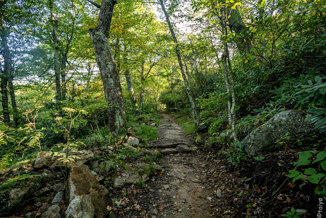
We have been trying to make a hike on one of the mountain trails in the general area: within 40 miles or so. Yesterday we hike up the Mt Pisgah Trail.
We found the trail 'demanding' as one hiker that was on the way down said; "the last half mile is pretty demanding, but you have your sticks so you should be fine." We were fine and the last half was challenging for us older hikers. It started off looking like this and was equally beautiful all the way to the top.
And not only was it steep—
it was. almost, all rocks:
I had the idea that at the top there would be a cleared space (and a porta potty) but nothing was cleared and only a 20' octantal was standing up in the brush.
The view was specular and we sat for a bit, and a bite, and headed back down. I didn't take any photos from the top because, well, the ones i've taken from the top of other peaks never pleased me ... there is usually too much haze (yes i know LR can handle haze) and the view so vast, my little sensor just laughs at me trying to put that much territory onto an inch size piece of technology. So, no photographs of the top!
To add excitement to the journey back down, it began raining about half way down and we increased our pace. Thankfully, it stopped and waited until we were a few hundred yards from the car and then the skies opened up raining as hard as it often does in the mountains.
It was a good hike and about the outer limits of our abilities although we are noticing those abilities are increasing with the more we hike such trails.


No comments:
Post a Comment